This article is part of the FA special series Cities After Algorithms.
For close to a century, the Israeli project has maintained the Gaza Strip as a tightly-controlled laboratory for testing novel technologies of weaponry, surveillance and containment. A few months prior to the short-lived ceasefire agreement in January 2025, a PDF produced by the nation-state spread across the internet. This PDF may well be considered an imperial weapon in and of itself.
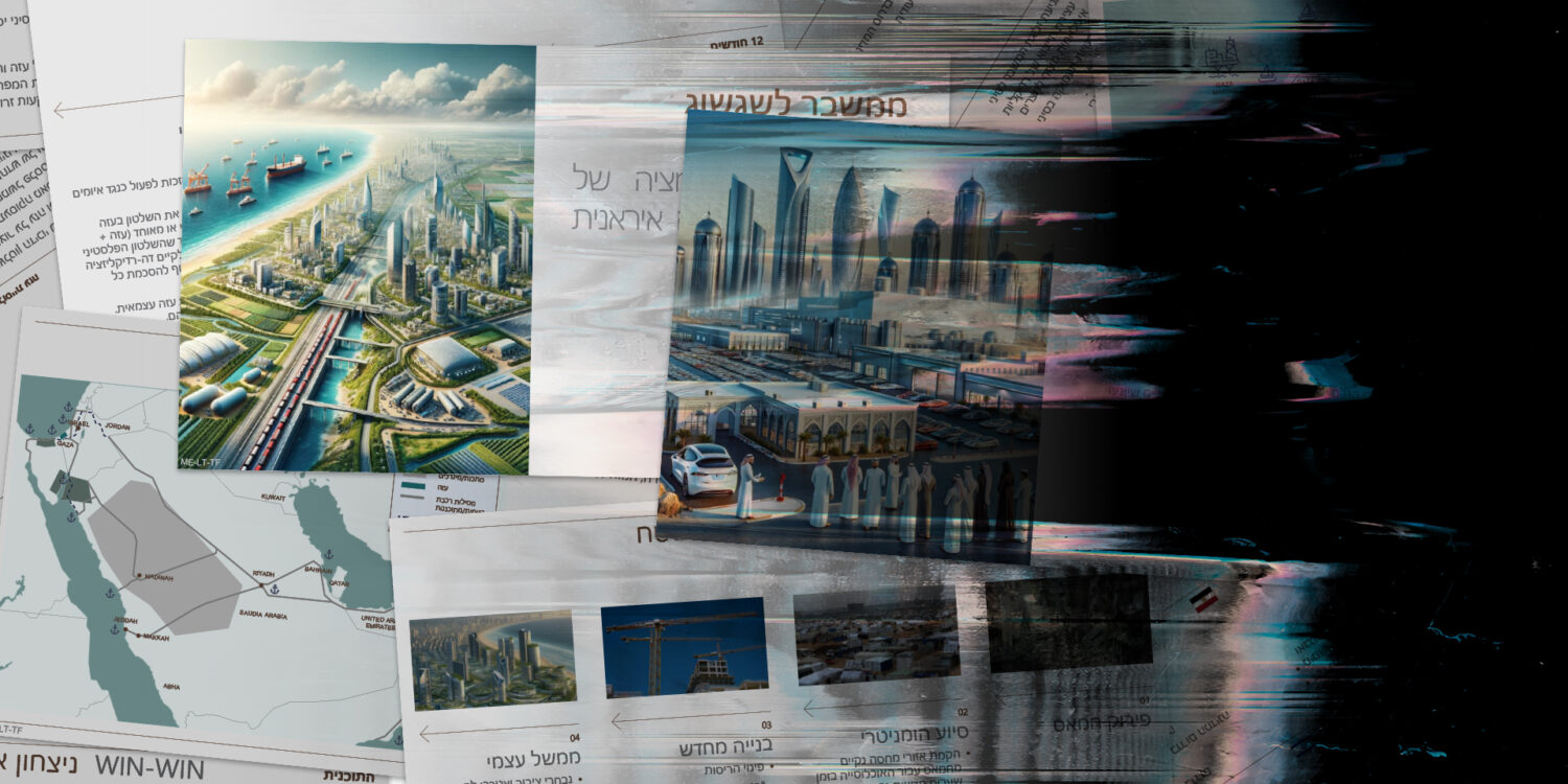
Gaza 2035 — a document produced in Spring 2024 that purportedly outlines Israeli prime minister Benjamin Netanyahu’s vision for the 25-mile-long territory — demonstrates how unbounded the settler colonial imagination is when the subject of containment is perceived as a thing of the past. A glimmering trade and energy hub appears where there are currently miles of tents and smoking rubble. The border infrastructure is erased to make way for a boundless metropolis of solar fields, electric vehicle factories and high-speed railways under Israeli security control. The accompanying text envisions Palestinians running the “safe zones” under the supervision of the Arab states.
Not by coincidence, a train line connecting Gaza to NEOM, a planned city being built by Saudi Arabia in Tabuk Province, is one of many proposals found throughout the document for a regional trade network. With a similar imperative to “modernize” the Middle Eastern coast by any means necessary, Saudi authorities were recently given license to use “lethal force” against those resisting relocation to make way for The Line, a 105-mile-long megastructure of mirrored glass at the center of NEOM. Several Saudi villages (including Khuraybah, Sharma and Gayal) have been demolished since 2018 with little to show for the destruction; the construction timeline has been delayed since the first public announcement while the project’s backers induce connections with global economic centers — including a future Gaza where Israel’s genocidal campaign is imagined to have succeeded.

An AI-generated bird’s eye view of Israel’s vision for Gaza
Israel PMO
Distorted images and vague descriptions of preliminary steps convey the Gaza 2035 proposal in its current iteration. These images intend to represent the smooth, logical, and efficient conclusion of Israel’s occupation. This final stage in Israel’s ethnic cleansing campaign hinges on the dazzling marriage of technology, urban planning and imperialism. “For the dominant global powers,” the critic Jonathan Crary writes in his book Scorched Earth, “the only tolerable horizon of expectation is one that confirms and extends the imperatives of the present, in which the unforeseen and unpredictable have been minimized or eliminated.”
Judging from their shaky line work and splotchy forms, it is apparent that the renderings, which have since gone viral across social media channels, were created using AI image-generation software, a method of representation ideal for conjuring the fantasies of a settler colony. The use of AI to visualize the future of such a contested geopolitical territory represents the nation-state’s latest commitment to a technocratic global order based on severe economic inequality — and, more generally, the inhuman logic lying at the center of the military industrial complex.
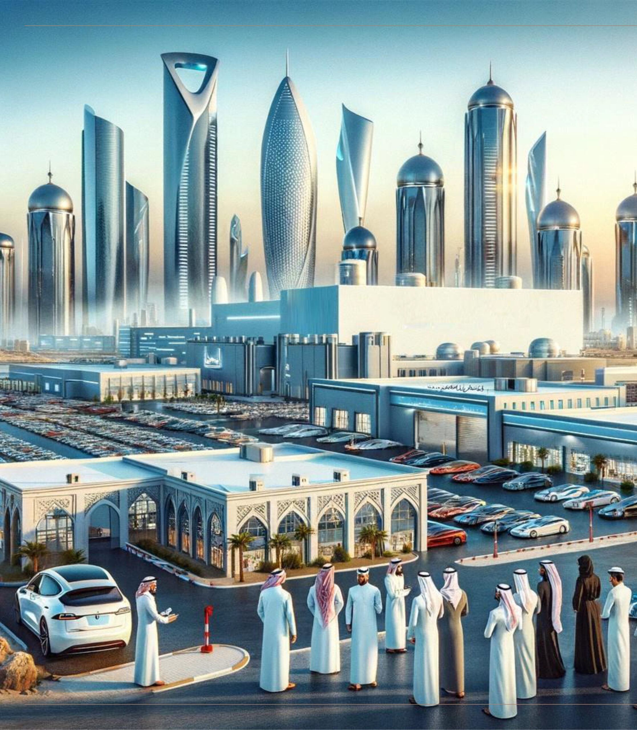
An AI-generated rendering of Northern Gaza as a hub for electric car manufacturing
Israel PMO
No other method of representation than AI-generated renderings could better match the speed with which the IDF has killed over an estimated 186,000 Palestinians and displaced almost two million more since October 2024, nor the speed required to turn so much destruction into a metropolis in only 11 years’ time. No other method could better reflect an economy with more than 2300 AI technology companies, many of which have developed tools for violating the human rights of Palestinians (such as “Lavender,” a program that generates an ongoing database of suspected terrorists, and “Where’s Daddy?,” which tracks their movements) to wield what has come to be known as the ‘world’s first AI war’ upon them. No other method could better depict a fantasy informed by the prime minister’s insistence that “Gaza 2035 entails ‘rebuilding from nothing.” The aerial perspectives used in the renderings obscure the imagined demographics of this bustling city of the future, yet it is implied that the Palestinians that currently occupy the site will be as absent as the barriers once used to contain them.
If, as Edward Said wrote, Palestine “has always played a special role in the imagination and in the political will of the West,” then what words were fed to the unfeeling machine that churned out these images? Anyone who has generated images using artificial intelligence software knows that it can feel like asking a genie for a wish: type in what you would like to see, and a picture will be granted in an instant. The more specific you are with your language, the more closely the result will mirror your imagination. We may never know what words conjured such images of Gaza, a land that has recently been pummeled beyond recognition, but the ideological origins of Gaza 2035 can be traced back through the lineage of Zionist image-making.
Like the Orientalist photography of the region from the late 19th century and early 20th century which, as the artist Jumana Manna argues, “freezes Palestine into an ancient or timeless past that has no present and is therefore available for expropriation,” the images of Gaza 2035 obscure its current condition for one more palatable to the colonial imagination. The fields of green in between the gleaming skyscrapers of this Gaza of the future additionally recall the use of landscape imagery found in mid-20th century Zionist posters promoting Israeli settlement, such as Franz Krausz’s 1949 illustration of Herzl Cedar Grove, a proposed memorial to the founder of Zionism in the form of a manicured forest replacing the site where a Palestinian community once lived and worked.
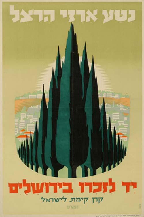
1949 illustration of Herzl Cedar Grove
Franz Krausz
The vast datasets of existing images on which AI was trained belong to the field of urban planning, a design discipline that has assisted nation-states in smoothing over colonial landscapes from lofty positions in the technological stratosphere for longer than Israel itself has existed. In these images of a colonized Gaza, early 20th century agricultural fields, mid-century highways, and early 21st century skyscrapers come together to form a single gelatinous whole. Depicted in this way, the plan carries on a project initiated in the colonial collages of 20th century urban planning. Daniel Burnham’s 1904 proposal for Manila, for example, slices up the city’s historic fabric with wide parkways while keeping intact the Spanish colonial architecture of the previous few centuries. Gaza 2035, and particularly the aerial view of its principal image, recalls many other images of top-down urban redevelopment schemes proposed throughout the early 20th century in pursuit of an infrastructure suitable to western powers. In bird’s eye views of Le Corbusier’s Plan Obus, we see an Algiers in which the predominantly-Muslim slums are surveilled from the 10th-century casbah where European settlers resided. Zeynep Çelik describes the oppressive conditions inherent to this top-down vision: “Le Corbusier’s plan establishes constant visual supervision over the local population and clearly marks the hierarchical social order onto the urban image, with the dominating above and the dominated below.” Compare this with the regular use of surveillance infrastructure within Gaza, which partially set the stage for something as totalizing as Gaza 2035 to feel plausible to those who drafted it.
In the present day — the allegedly ‘post-colonial’ stage of globalization — several investment groups and related business interests are pooling their resources to plonk new cities from scratch onto sites across the world assumed to be without cultural history. The logic of these investments figures each territory not as a place where lives will unfold, but as a proving ground for Internet of Things and AI technology that had previously only been tested within the infrastructural limitations of pre-existing cities. East Solano, for instance — a city of 400,000 residents near California’s Silicon Valley proposed by an investment team of Jan Sramek and other Big Tech billionaires — has been presented to the public through too-good-to-be-true AI-generated images of open skies and pedestrian-filled streets with an unprecedented scale of technological experimentation woven into the city’s urban fabric. In Gaza 2035, the eliminationist drive of the Zionist project is complemented by the capabilities of AI image generation to emphasize urban planning’s role in speedily “organizing” territory by removing human empathy from the creative process. This marriage of Zionism and Artificial Intelligence is additionally fueled by the capitalist impulse to remove any obstacles in the way of the international growth of neoliberalism.
The idea of a nation-state, as we have seen, is often composed of fantasies legitimized by sophisticated methods of visual representation. Artificial intelligence is merely the latest technology employed toward this end. Yet a counteractive project of representation, which imagines a borderless Palestine of another sort entirely, has been underway for some time.
Many more paths to Palestinian autonomy, however, are brimming with imaginations of their own, and are currently being dreamt up as alternatives to that of the Western order — not by unfeeling machines, but by everyday people. How will they generate their images?