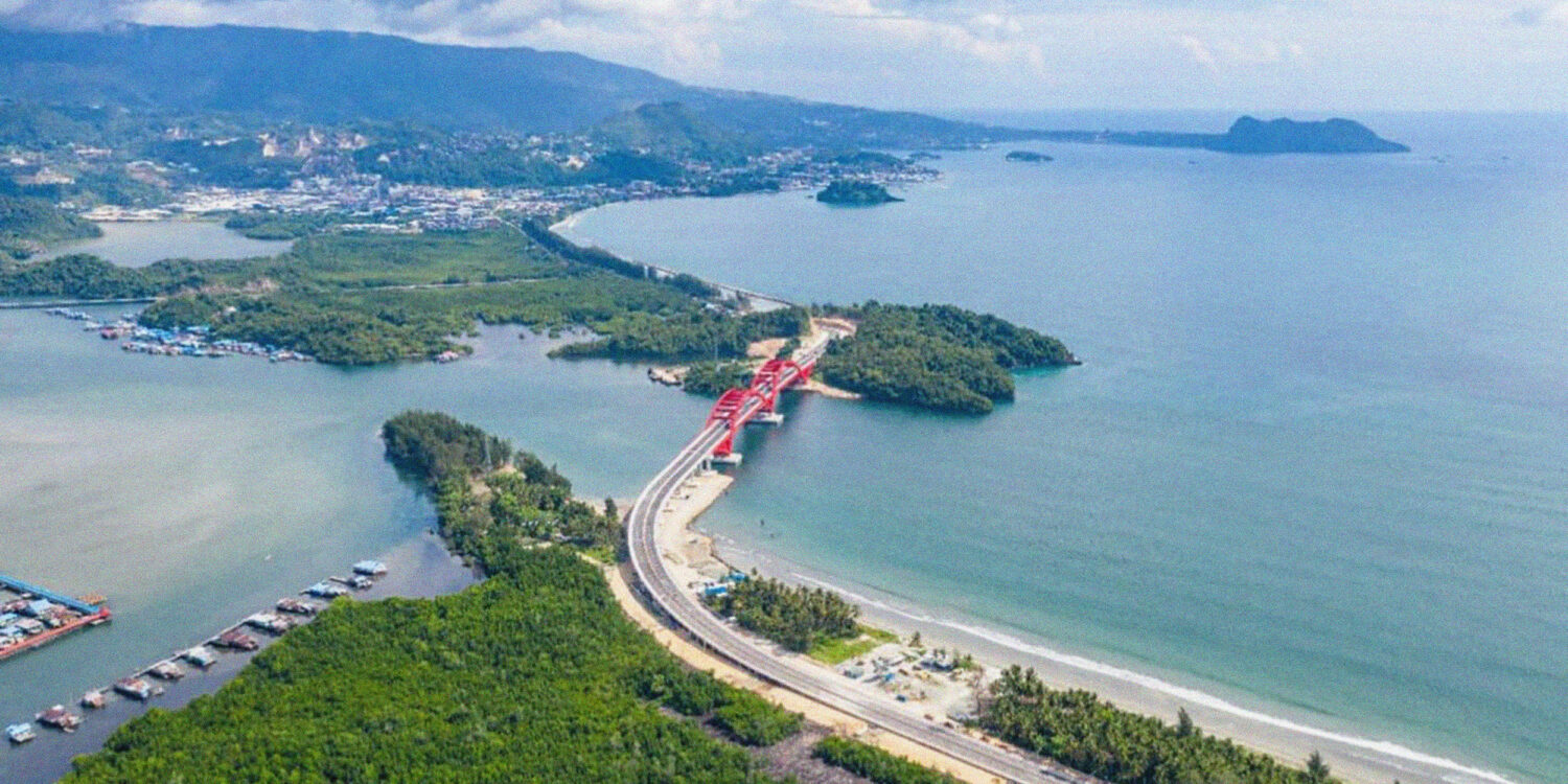
On Youtefa Bay, Jayapura, opening into the Pacific Ocean, spans the Youtefa Bridge at 732 meters long. It serves as then-president Joko Widodo’s first infrastructure project in West Papua, as part of the Trans-Papua road network, to ‘unite’ the nation through connectivity’. The bridge is at the epicentre of a multilayered series of socio-ecological problems, intertwining indigenous populations, the State, and the environment. Like in other colonised territories from occupied Palestine to Indigenous North America to Aboriginal Australia, infrastructure erases, reframes, and occupies. The Youtefa Bridge is a monument to settler-colonialist techno-power that perpetuates Indonesia’s imagination about West Papua–a land to be socio-ecologically extracted, integrating indigenous customary territories into its agglomeration of national development.
In West Papua, infrastructure operates as Indonesia’s tool of social and physical terraforming; determining which of the landscapes, forms of life, agencies, and identities are possible within the Papua-Indonesia nexus. Paige West refers to this as autochthonous ideologies: rendering people, places, and times as static, exotic objects, while excluding anything dissonant. This process reduces Papuan identity into a monolithic mosaic piece within Indonesia’s brand of state multiculturalism—static beings, exotic creatures, and national assets waiting to be appropriated and commodified. These logics divide the West Papuan identity into finite governable units, dispossessing their agency over territory and resources. However this has contradictorily shaped West Papuan resistance into a generative refusal that has multiplied its specificities.
In Jayapura, this refusal comes face-to-face with Indonesia’s most recent intrusion, the Youtefa Bridge. The bridge is a multiscalar and multilayered notion: from Youtefa Bay’s indigenous designation as a socio-ecological entity, Jayapura’s extended urbanisation, and a movement for West Papuan nationhood, it reveals the opaqueness of Indonesia’s territorialisation under the guise of development. Built by the government through the Ministry of Public Works between 2015 through to 2019, the million-dollar bridge towers over the bay and mangrove forest, inadvertently degrading local flora and fauna. The need for a bridge across the bay came out of Jayapura’s expanding urban sprawl and rugged terrain. The flatlands of Muara Tami district, bordering Papua New Guinea and serving as an agricultural transmigration enclave, offered a solution. The government saw this area as “an abundance of land spread … along the Koya area heading toward Skouw”, and prompted them to connect the two separate areas with a bridge, offering a ‘solution’ through land optimisation.
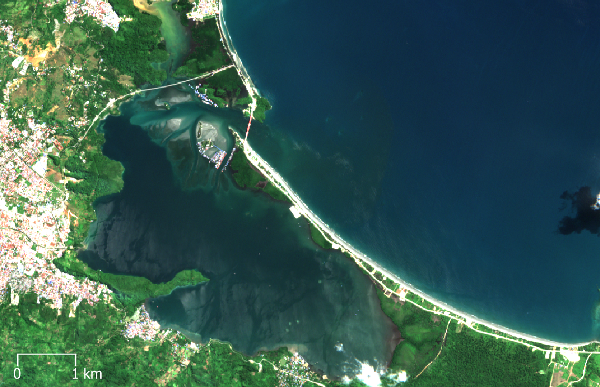
Sentinel 2 surface reflectance image of the Youtefa Lagoon on 2021-08-08 shows vegetated and inhabited barrier beach.
Contains modified Copernicus Sentinel data 2021. European Space Agency. Via Wikimedia Commons
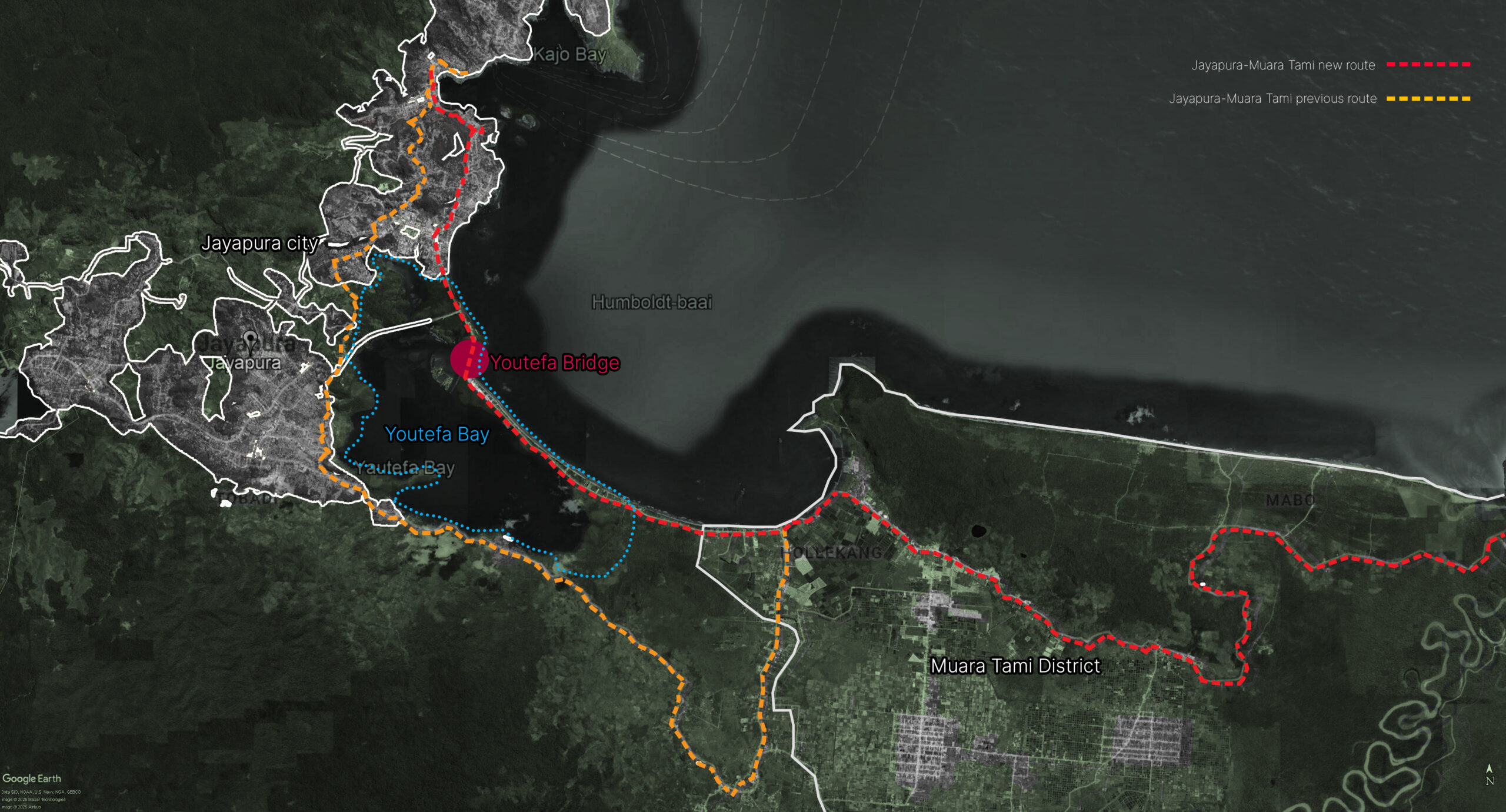
Jayapura city to Muara Tami connectivity
Diagrammed from Google Earth
Youtefa Bridge extends from Pie Cape in Hamadi in the east to Ceweri Cape in Holtekamp in the west, and was constructed under a single infrastructural package. This route streamlines access from Jayapura’s urban core, reinforced by the formation of both peninsulas that provide an ideal site for efficient bridge and road construction. Youtefa Bay, located between Jayapura and Muara Tami, had “potential economic value”, motivating the government to designate it as the Rowing Venue for the 20th National Sports Week, the Indonesia–Papua New Guinea Border Crossing Post at Skouw, whilst also promoting tourism at Holtekamp beach. The bridge thus crystallises a new spatial logic: leveraging Jayapura’s growth, strategic peninsulas, shallow coastlines, and growing economy to spatially engineer Youtefa Bay, producing a technological framework imposed onto the bay’s intricate landscape to assert control against local needs. Youtefa Bay is then reduced to a legible grid, with mangroves and beaches framed as idle land, casting the bay with vacant possibility.
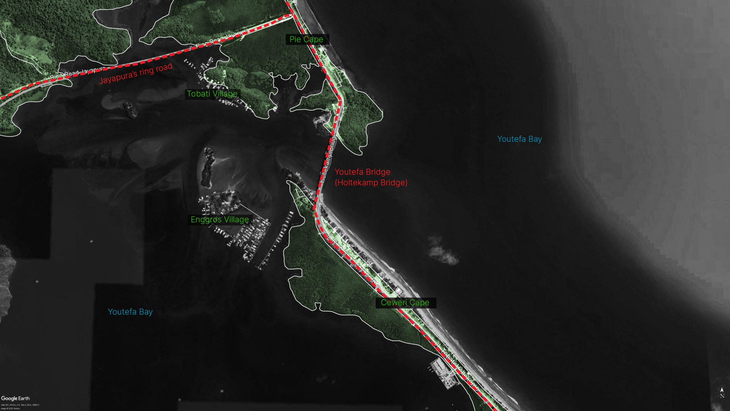
Youtefa Bridge and adjoining roads on Youtefa Bay
Diagrammed from Google Earth
Youtefa Bay, however, is far from idle land. It is regulated by a customary law called Manjo, carried out by three communities: the Tobati, Enggros, and Nafri through stewardship rather than ownership, in which borders are not exact but defined by relationality. The Tobati-Enggros territory is deeply entangled with the local aquatic and mangrove ecosystems, and the people are culturally led by a customary leader, known as the Ondoafi. Under Manjo, livelihoods follow gendered roles: men fish the Youtefa and Yos Sudarso bays using semang-semang boats, while women harvest bianoor/ftah (shellfish) from mangrove forests on kole-kole canoes. Catches primarily sustain households, with surplus sold at Hamadi Market in Jayapura. Over time, this practice expanded to include vegetables sourced from Holtekamp, sold alongside seafood. Youtefa Bay also possesses high fauna biodiversity such as fish, shellfish, birds, reptiles, and macrozoobenthos. The ecosystem itself is composed of a symbiotic coastal triad: mangrove forest, coral reefs with a hard coral cover, and seagrass beds. In a bay ecosystem, mangrove forests serve as a fundamental foundation for the aquatic food chain by providing feeding, spawning, and nursery grounds, while also playing a vital protective role against tsunamis.
Culturally, mangrove forests have intricate bonds with the Tobati-Enggros. Tonotwiyat (tonot: “call,” wiyat: “mangrove”) is a mangrove forest stewarded by Tobati-Enggros women during low tides and rainy seasons. Governed by Manjo, the space bars the entry of men, as women traditionally bathe unclothed while harvesting shellfish. Beyond its ecological role, Tonotwiyat acts as a socio-cultural nexus: women gather here to share concerns, elders mentor newlyweds in harvesting shellfish, collecting firewood, and managing households. This dual function of fostering female community bonds while regenerating biodiversity makes Tonotwiyat a regenerative-reproductive space in Youtefa Bay.
Despite the site’s intricate character, the bridge and its adjoining road slice through Tonotwiyat’s mangroves, severing their socio-ecological entanglements. Infrastructure construction, mangrove clearing, landfill, metal and concrete reinforcement, encroach further as tourism expands by land conversion, exposing sacred female spaces. These materialisations induce mangrove loss, increase sedimentation, kill reef and seagrass, reduce coral photosynthesis, and fisheries and shells collapse. For the community, women suffer a loss of authority, reduced shellfish harvest, and lessening women participation, ultimately undermining Tonotwiyat and what it means to be a Tobati-Enggros woman.
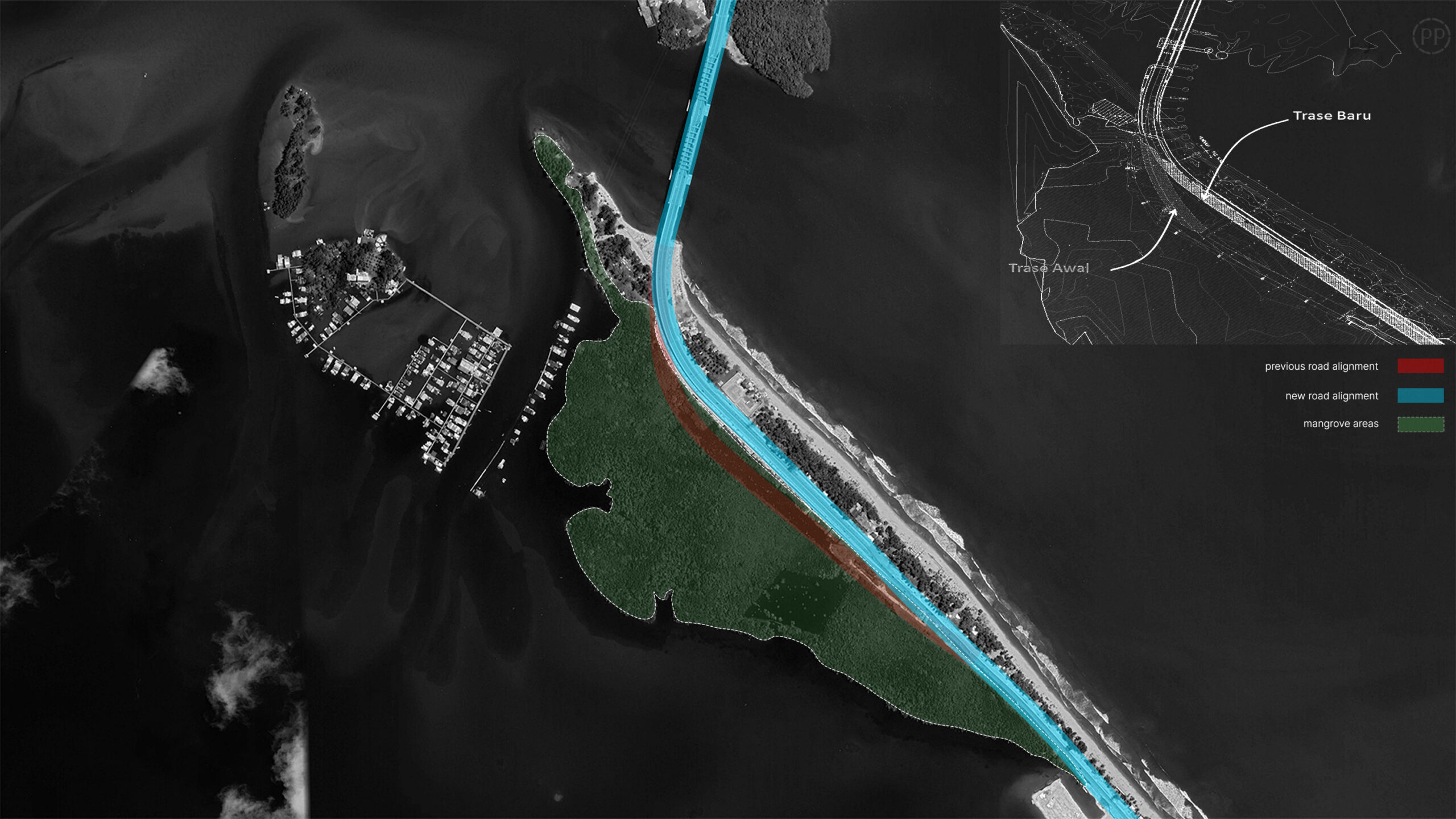
20-meter shift of the Holtekamp alignment
PT PP (Persero) Tbk technical documents overlayed on Google Earth
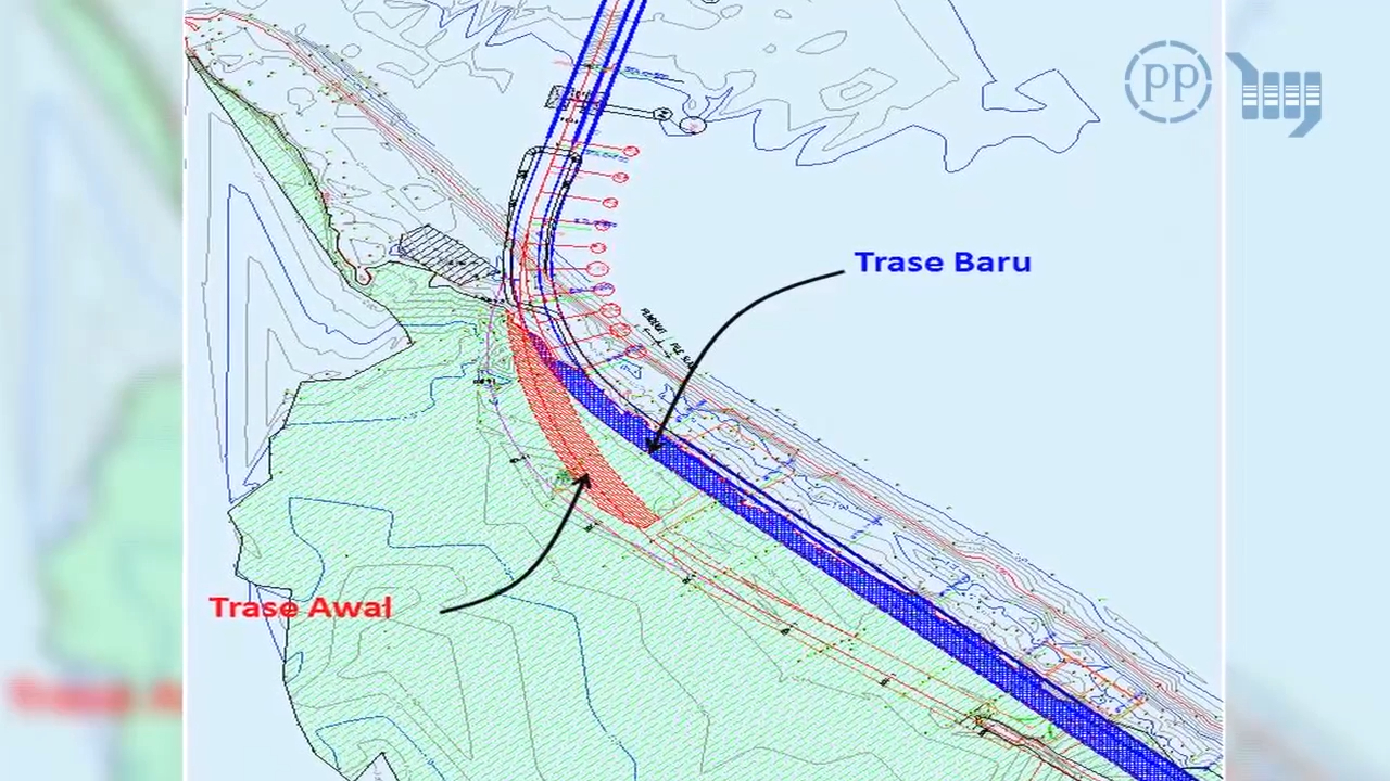
During its construction phase, the Youtefa Bridge project faced multiple challenges. Initial environmental concerns were raised by local communities and the Forum Peduli Port Numbay Green environmental group, which highlighted the impact on 4.2 hectares of mangroves along a 250-meter section of the Holtekamp alignment. In response, state planners revised the bridge design, shifting its alignment by 20 meters. Subsequently, “social conflict among local tribes” over land compensation arose between the Enggros and Nafri, contesting ownership over the area. This disagreement required six months of negotiations mediated by government authorities and customary leaders to resolve. Construction teams also include locals in community discussions and in the project as local workers to further ease negotiations.
The project was planned to be a 5000-km multi-site assembly line; contracts from Jakarta, designs from Bandung, concrete from Bitung, spans from Surabaya, and installation in Jayapura. This “circumscribable arena of intervention,” as critiqued by professor Tania Li, required filtering out “refractory processes” such as “local conflict” to render the local context depoliticised in order to formulate a problem that can be solved. The construction team, a consortium of three state-owned firms; PT Pembangunan Perumahan, PT Hutama Karya, and PT Nindya Karya, minimised on-site work by shifting conventional concrete to precast concrete and redesigning assembly methods. Initially planned for on-site construction, the bridge spans were instead fully fabricated in Surabaya and shipped to Jayapura, significantly reducing time with additional costs. This project successfully achieved goals by circumventing Youtefa Bay’s socio-political complexities by relegating its role to a mere site for installation, embodying the state’s vision on West Papua as a terra nullius, the colonial doctrine weaponised to justify occupying “underdeveloped” territories by denying indigenous practice.
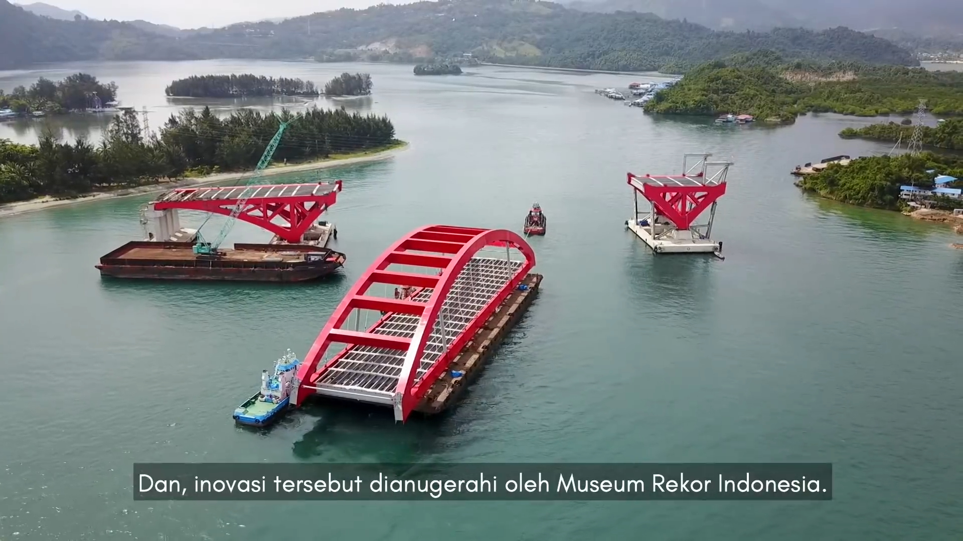
Bridge spans elements being transported
Official Joko Widodo Youtube Channel
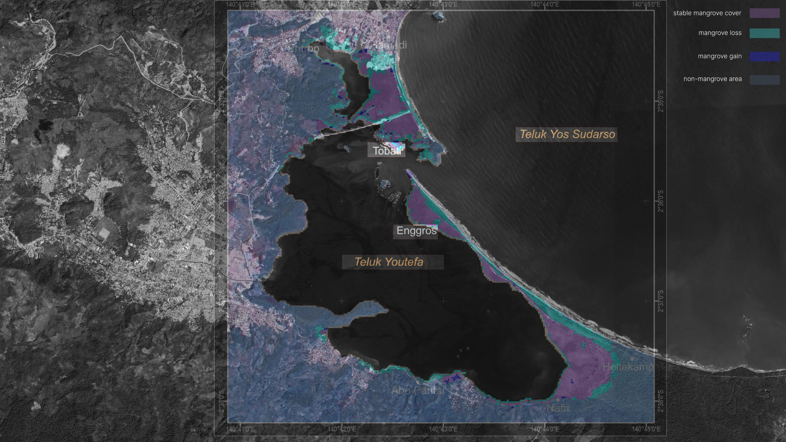
Mangrove area changes 1994-2017
Hamuna and Tanjung, overlay on June 2017 Google Earth
Through this doctrine, the bridge reconfigures communal customary territory into the Indonesian state’s public space by replacing communal rights with private property logics through land acquisition. “When the Ondoafi and tribal chiefs signed the release letter, a transaction of sale and transfer of land use took place,” said a Tobati-Enggros woman named Petronela Merauje. Negotiations occurred in para-para adat, a male-only forum that excluded women from advocating for Tonotwiyat. By fragmenting Youtefa Bay into “public” and “private” zones, the state enacted a parallax shift; monetizing land while erasing the dividual relations that bind the Tobati-Enggros to their territory.
This spatial transformation imposes the meaning of public and individuality on the Tobati-Enggros by appropriating territory as “public” space while expropriating cultural sovereignty. Through infrastructure, the state turned the regenerative-reproductive space of Tonotwiyat into a productive tourism asset to be perpetuated through development. Youtefa Bridge, then, becomes a new milieu for Youtefa Bay as another node of capitalist agglomeration in Jayapura. This new milieu is enforced through governance regulation: weekends host car-free days and bazaars on the bridge, while adjacent lands are zoned for commerce and primary arterial roads. Tobati-Enggros villages, now state-designated “tourist villages”, face contrasting divergence; acceleration of flourishing economic activity while stagnating Tobati-Enggros women’s sovereignty.
The Bridge also accelerates land sales among the Tobati-Enggros, driven by increased land scarcity and declining viability of traditional livelihoods under continuous extended urbanisation. As a settler-colonial apparatus, extended urbanisation is a tool for Indonesia, stretching its spatial hegemony to Jayapura as a constant colonial frontier. Building on Simone’s concept of extensive urbanisation, this process operationalizes settler colonialism through infrastructural violence of state-backed transmigration with Indonesian migrants acting as settlers. Labeled as Amberi (straight hair) by Papuans to identify intruders, settlers operate infrastructures on land taken from Papuans such as the Tobati-Enggros. In doing so, they utilise infrastructure like the Youtefa Bridge to accumulate capital as tourism entrepreneurs, renters, or foreign-investment intermediaries. This violence becomes a structure practiced by settlers, obscured by the legitimacy of public interest works through the paternalistic figure of Indonesia “lending a hand” to its perpetual periphery.
Despite this, Papuans have turned colonial dispossession into a generative refusal, a way to exist beyond the state’s grip while nurturing alternative futures, challenging colonialism. While para-para adat is restricted for women, Tobati-Enggros women have reclaimed mangroves as their “kitchen”, occupying “public space” echoing the 1988 flag-raising ceremony organised by Papuan intellectuals Wainggai and Keiliele at Jayapura’s Parliament Office. These collective refusals exemplify Papuan resistance centered in Jayapura, rooted in historical struggles for self-determination, manifested through interstitial space-making rendered ambiguous to state spectacles. For instance, while Jayapura’s flatland development has pushed Papuans to the outskirts, they have leveraged the city’s rugged terrain as sanctuaries to sustain livelihoods and existence. Hence, expanding road infrastructure to this rugged terrain is how the state inadvertently flattened the topography of refusal in taming ungovernable territory. The city then exists as a paradox: simultaneously a site of state domination and Papuan resilience, where development projects catalyse Papuan resistance world-making. Jayapura ‘non arrival’, in Simone’s term, embodies Papuans’ strategic endurance; a refusal to capitulate to settler-colonial urbanisation.
Reconstruction of the flag of the ‘Koreri’ resistance movement of West Papua against Japan in World War II
Wikimedia Commons
Papuan resistance traces its roots to a centuries-old refusal of subjugation. Beginning in the 1850s, such consciousness had already begun to manifest with the emergence of the Koreri, a movement formed in refusal to foreign occupation. Over time Koreri gradually became a proto-West Papuan nationalist movement, marked by an early 1930s uprising led by a woman named Angganitha Menufandu, which was a direct resistance against Dutch colonialism, a system that positioned Papuans at the lowest stratum of the colonial hierarchy. This legacy of defiance crystallised into self-determination and sovereignty of their own world-making, symbolised by the Morning Star flag: a cosmopolitical emblem linking the memory of the Koreri Movement, the global Free West Papua anti-colonial struggle, anti-racism solidarity, trans-indigenous refusal, and broader networks of liberation culminating in the declaration of West Papuan independence on 1 December 1961.
Despite Indonesia’s annexation, resistance deepened and was moved from the coast towards the territory’s remote highlands. The Arfak Uprising in 1965, along with other regions, declared armed resistance against any colonial power, both Dutch and Indonesian, became a momentum for coastal-highlands resistances and ignited a protracted struggle for liberation that continues to echo across generations through the Free Papua Movement.
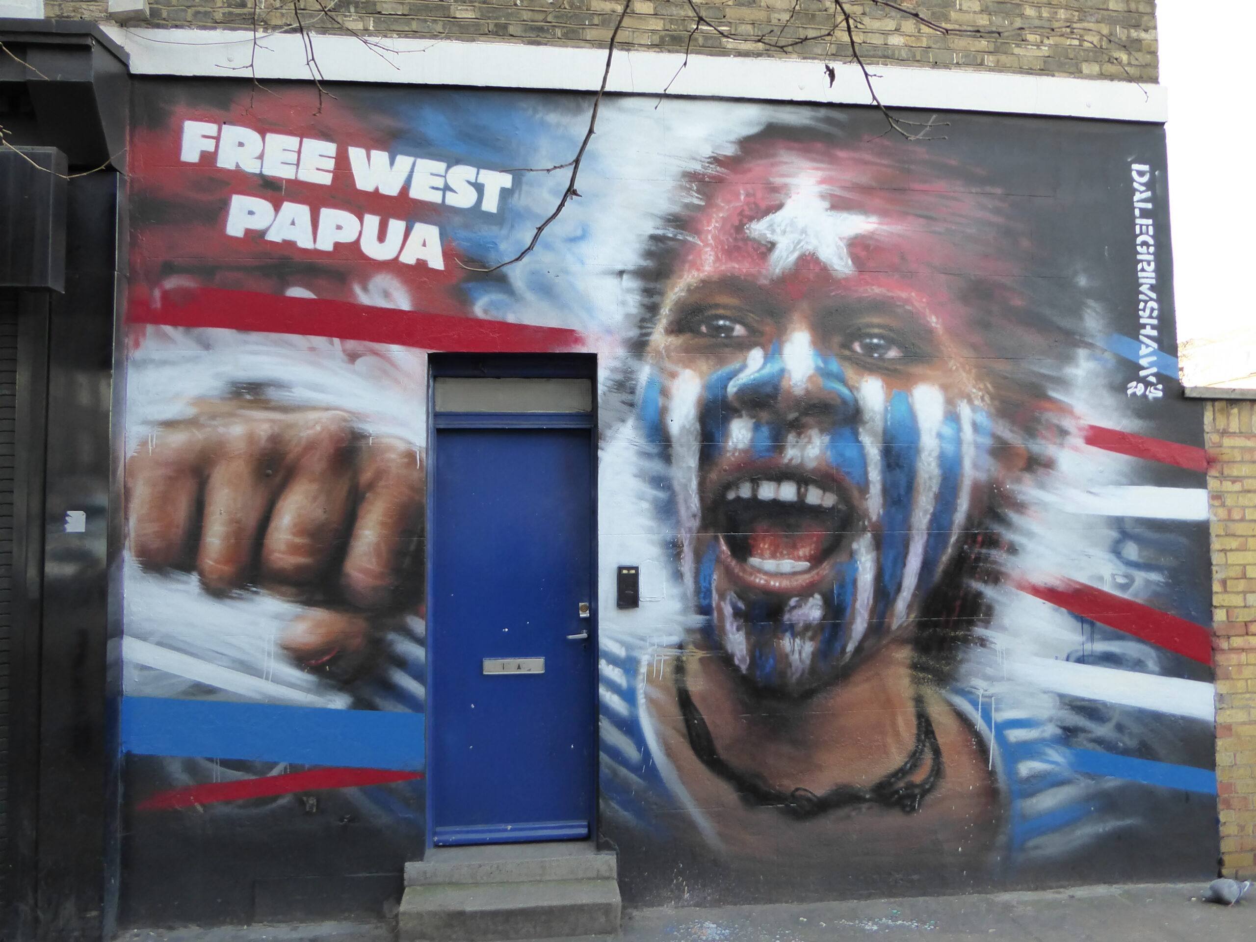
Free West Papua Graffiti in London
Matt Brown, Flickr
Webster describes the West Papua movement as a process of becoming ‘notion-state’ as ‘point of no return’. Indonesianisation paradoxically helped shape a more interconnected and resilient nationalist consciousness. The West Papua spring between 1999-2003, backdropped by the Indonesian economic crisis, marked a temporary shift towards a less militarised approach to Papuan governance. The Special Autonomy Law was introduced as a ‘win-win solution’ although in practice it became a tool for opaque mass elimination of Papuans, coupled with a significant increase in the deployment of security personnel under the guise of development. Simultaneously, diverse Free West Papua movements arose both domestically and globally, signaling a Pan-Pacific wave of resistance and renewed interconnectedness; embodied in the call to ‘bring West Papua back to the Pacific Family. Indonesia responded by attempting to co-opt Melanesian cultural connectedness, framing it as part of Indonesia’s multicultural fabric in order to buffer against the internationalisation of the West Papuan cause.
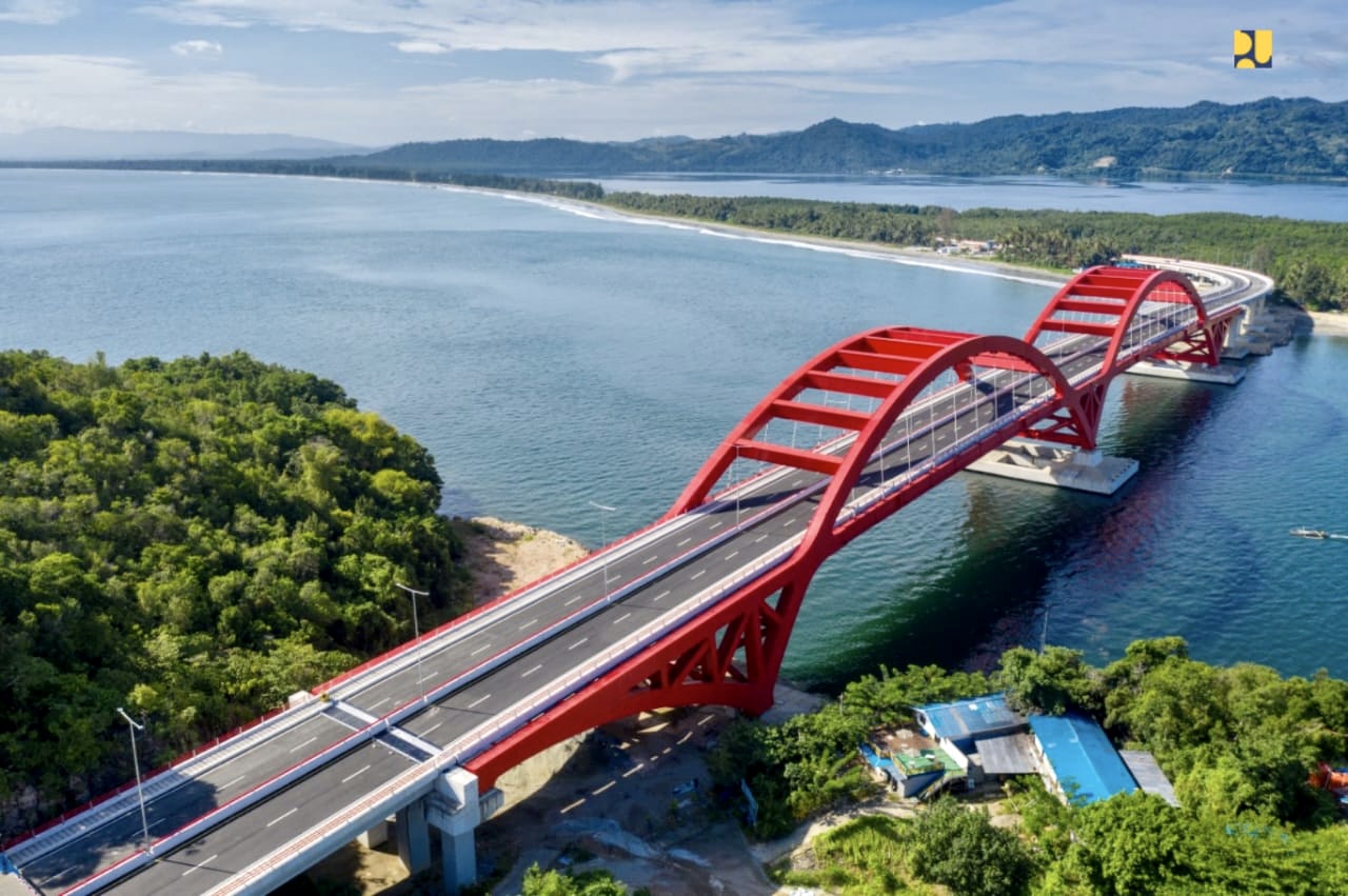
Aerial view of Youtefa Bridge
Ministry of Public Works and Housing of Indonesia
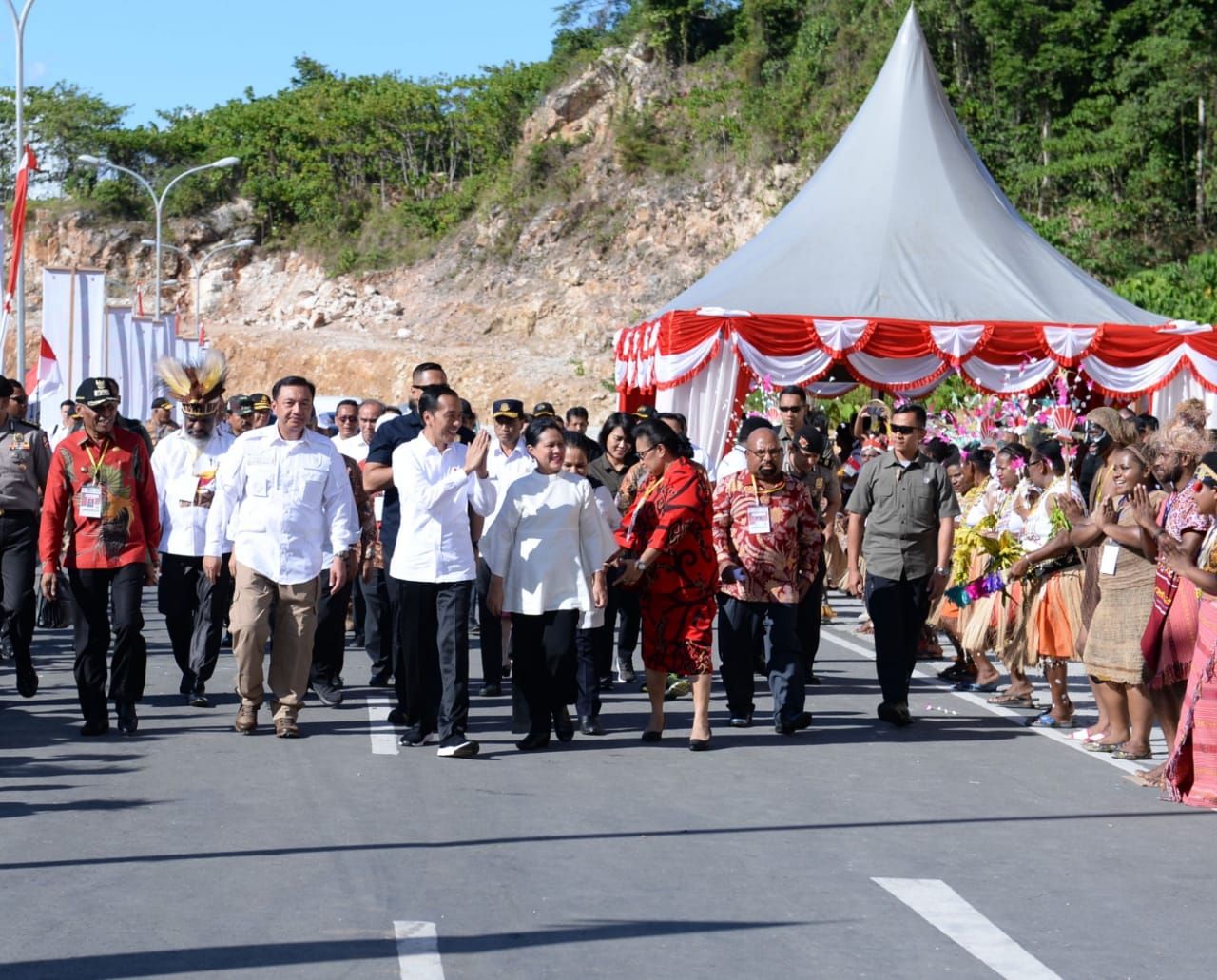
President Joko Widodo inaugurating the Youtefa Bridge in Jayapura City, Papua Province, on Monday, October 28, 2019.
Official website of the President of the Republic of Indonesia
Indonesia’s fabricated ‘interconnectedness’ is a direct response to West Papuan interconnected refusal and resistance against militarised suppression and infrastructural connectivity as a means of softening and obscuring violence. The Youtefa bridge, then, acts as a monument to simultaneously situate and immortalise those means through concrete and steel.
Resistance movements do not appear openly or target the Youtefa Bridge specifically, but instead are interstitialised in everydayness of refusal, articulated through a variety of direct and indirect actions. The most common action is road blocking access to the Youtefa Bridge as a response to various issues of inaccessibility such as land compensation and dissatisfaction with election results, notably by male members of the Tobati-Enggros community. On the other hand, female members addressed Tonotwiyat’s ecological issues by organising various waste collection activities, while also questioning the inaccessibility of women-based economic activities around the bridge. However, out of the drastic changes to community life due to the bridge, different arenas of refusals emerge: crowds of people drunk and fighting, traffic accidents, people falling, illegal street racing, and constant public annoyance–all encroach the sacred space of Tonotwiyat, yet are forms of refusal intertwined within a colonial-prescribed condition which continually generates other forms of futurities.
As West Papuans reclaim their converted customary lands as “public place” in an act of refusal, Indonesia responds by welding infrastructure and settlers together into a design system of erasure. Infrastructure deploys violence, while settlers animate it by functioning infrastructure accordingly. Within this context, this system is designed to perpetually anticipate threats – the threat being Papuans themselves, who are rendered separatist until proven public, then eventually turned into docile citizens. Youtefa Bridge exemplifies this technology. Its creation requires both the appropriation of Youtefa Bay and the expropriation of its sovereignty, destroying a socio-ecological entity to build a state-owned public space. The dispossession that marginalises the Youtefa Bay anticipates threats, while defining threats as those who do not take on the role of the public. Its existence forces Papuans to integrate into the capitalistic economy–but to integrate is to let go of indigenous identity and become national citizen.