Considered by architects a great failure due to a number of reasons – from its patent ugliness to its inability to operate on an urban scale – Octavio Frias de Oliveira Bridge did succeed in what was apparently its main purpose: the endeavor of creating a global city image for São Paulo while covering up the city’s severe contradictions and conflicts.
Octavio Frias de Oliveira Bridge – named after a Brazilian businessman responsible for creating one of the most influential media organizations in Brazil, the conglomerate Grupo Folha – was inaugurated on May 10th, 2008. The ceremony, attended mainly by politicians and high profile businessmen, was accompanied by a small demonstration against the prohibition of pedestrians and bicycles on the bridge.
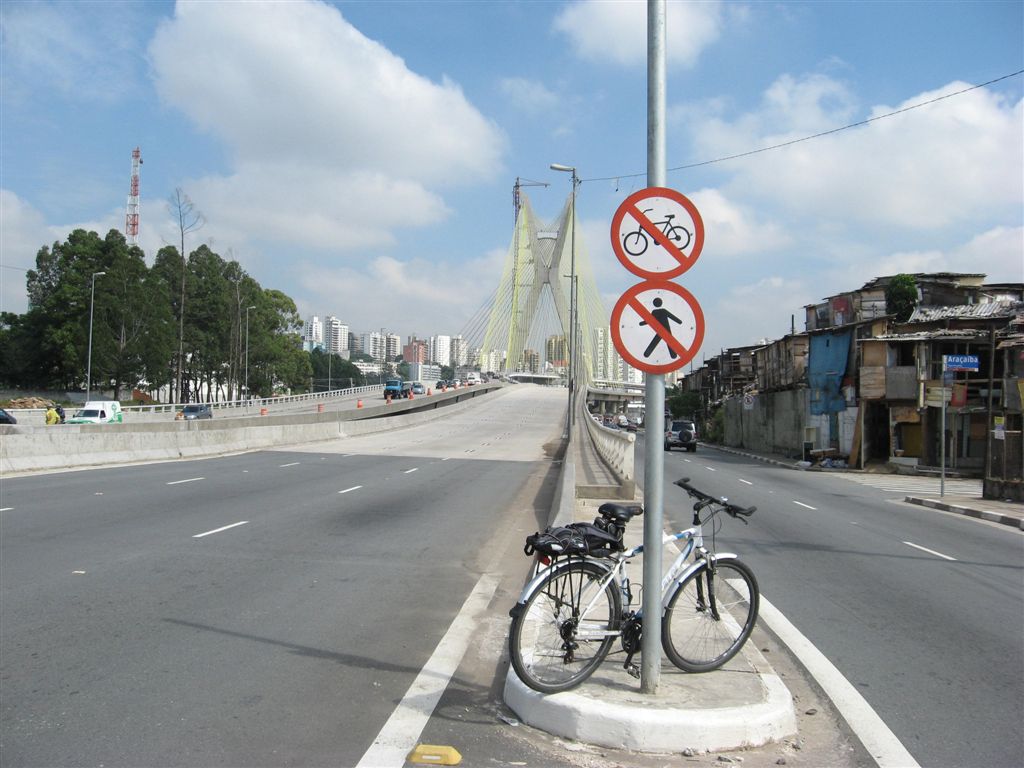
Access point to the bridge: no pedestrians or cyclists allowed.
André Pasqualini / CicloBR
The exclusiveness given to individual transportation is not only startling due to the inexistence of bicycle lanes or sidewalks. Rather than being an urban bridge – characterized by the flow of pedestrians, bicycles and public transportation, along cars in lower speed –, this particular cable-stayed bridge was conceived as a piece of metropolitan-scale infrastructure, connecting expressways instead of neighborhoods. As a result, the bridge is (yet) another infrastructural element in São Paulo that provides articulations in a large scale – and in this case only for individual transportation – while undermining local accessibility.
In a city already jammed by its excessive number of cars, and where the average distance between bridges over the city’s main rivers is around 2 km, should we really invest such a large amount of government budget – $113 million, at the time – in an extravagant public work that doesn’t even connect the neighborhoods in opposite river banks, or allow people to cross it by foot, bicycle or public bus?
Map of São Paulo’s centralitie.
H. Frugoli Jr., EdUSP, 2006
Investigating the process
The construction of Octávio Frias de Oliveira Bridge was part of a larger process initiated by the Água Espraiada ‘Urban Operation’ (a legal instrument for urban policy), which intended to create a new tertiary centrality in São Paulo. This new designated centrality would be developed on the lowlands of the Pinheiros River, once a large swamp with very cheap properties (whose prices, as a result, grew exponentially in the last two decades).
‘Urban Operations’ allow for great transformations in a specified area by means of associations with private investors. In these areas, urbanistic regulations such as floor area ratio can be much higher upon payment of an ‘onerous grant’. The accumulation of grants generates funds which should be invested in the same area, providing infrastructure, social housing, public spaces and other items which are not commonly provided by the real estate market.
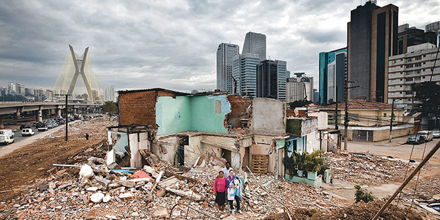
Demolition of Jardim Edite favela and surroundings.
Marcelo Min / Revista Época
In the case of ‘Urban Operation’ Água Espraiada, most resources were invested in road infrastructure, undermining the importance of providing social housing for the large number of local dwellers who had been displaced. Six times more money was spent on the bridge itself than the complex with 252 social housing units and public facilities (nursery, restaurant-school and health center) that has been recently – and still partially – inaugurated. Whereas all the favelas in the area were demolished, only ca. 5% of the local dwellers remained in the area, relocated in this new complex. The vast majority, however, ended up expelled and moved to other favelas in the city’s outskirts, out of the elites’ sight.
The bridge as an ideological icon
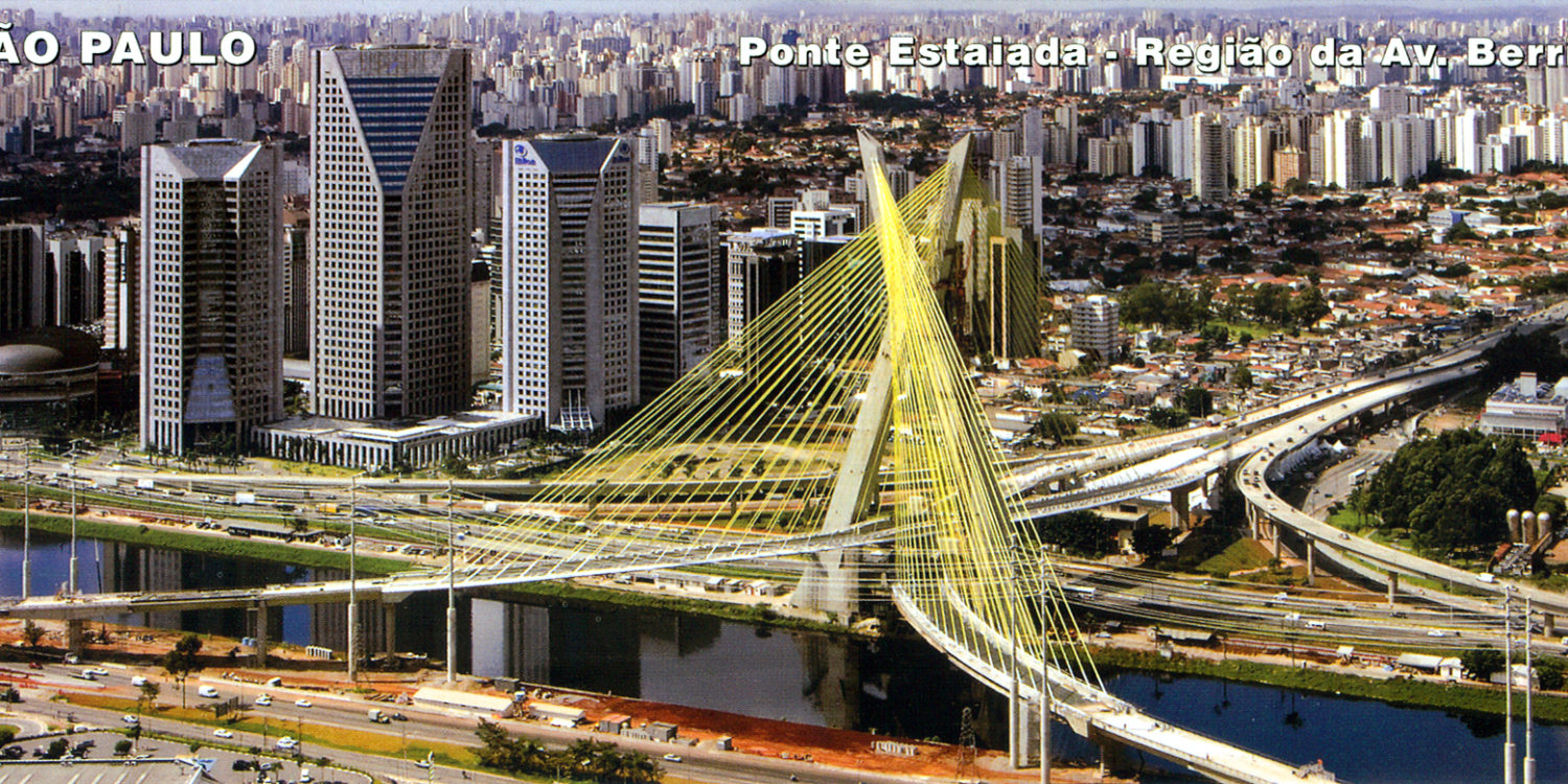
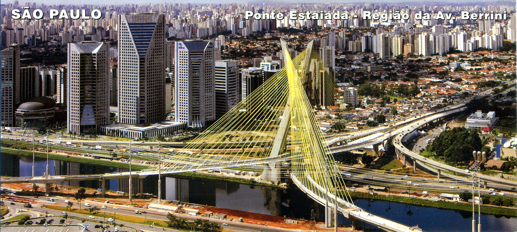
Octávio Frias de Oliveira Bridge worked out as an anchor project in the redevelopment of Berrini Avenue as a new centrality in São Paulo. Within a complex of corporate architecture buildings along the Pinheiros River, it created the perfect scenery for São Paulo to be seen as a global city, with a prominent, competitive and attractive economy.
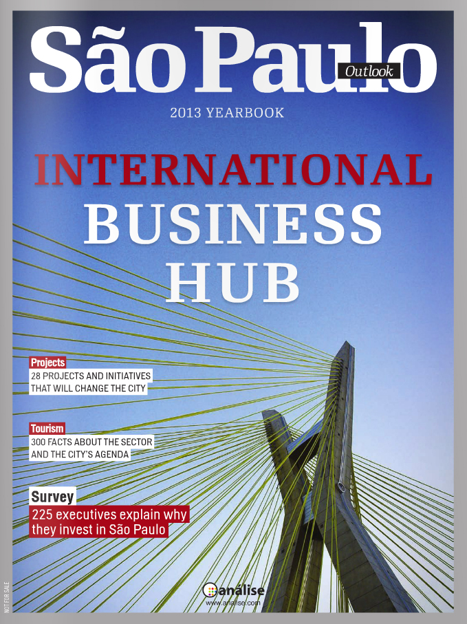
São Paulo Outlook Magazine 2013 cover: an icon of São Paulo as a global city.
The idea of a global city, conveyed by this glaring landscape – identical to many others around the world –, was imposed as a consensus by the city’s main actors. Fascinated by the idea of possibly living in an ‘alpha city’ such as New York, London or Tokyo, most of São Paulo’s population legitimized this disproportionate public expense. The Cable-Stayed Bridge, as it is most known, is now cherished by most of the paulistas as the city’s main postcard.
There is, however, a huge gap between this image of São Paulo as a global city and the reality it tries to hide: a city with deep contradictions within its urban conditions, where social differences can be radically steep. The undertaking of building this bridge while sweeping out of sight the favelas and its dwellers and looking down on urban mobility and connectivity reveals to what extend it is still possible to broaden both social and physical distances in São Paulo.